


Tiruvannamalai (Tamil: Tiruvaṇṇāmalai IPA: [ˈtiɾɯʋaɳːaːmalɛi̯], also Thiruvannamalai or Trinomali and Trinomalee[2] during British times) is a town in the Indian state of Tamil Nadu. The city is administered by a special grade municipality that covers an area of 13.64 km2 (5.27 sq mi) and a population of 145,278.[1] It is the administrative headquarters of Tiruvannamalai District. Roadways are the major mode of transport in Tiruvannamalai, while the town also has rail connectivity. Chennai International Airport is the nearest domestic and international airport to the town. Tiruvannamalai is named after the central deity of the Annamalaiyar Temple, Annamalaiyar. The Karthigai Deepam festival is celebrated during the day of the full moon between November and December, and a huge beacon is lit atop the Annamalai hill. The event is witnessed by three million pilgrims. On the day preceding each full moon, pilgrims circumnavigate the temple base and the Annamalai hills in a worship called Girivalam, a practice carried out by one million pilgrims yearly.
Apart from other temples, there are 8 important shiva temples facing 8 important directions on the (side) path of Girivalam. All the Shivlings of these 8 temples are believed to have formed naturally. [3]
Located on the foothills of Annamalai hills, Tiruvannamalai has been ruled by the Pallavas, the Medieval Cholas, the Later Cholas, Hoysalas, the Vijayanagar Empire, the Carnatic kingdom, Tipu Sultan, and the British. It served as the capital of the Hoysalas. The town is built around the Annamalaiyar Temple like other Nayak capitals. Tiruvannamalai is administered by a special-grade a municipality constituted in 1886. Tiruvannamalai has an average elevation of 200 metres (660 ft) and experiences a hot and humid climate. Being a pilgrimage town, most of the people are employed in the tertiary sector. There are 25 elementary schools, nine high schools, 18 higher secondary schools, four arts & science colleges, one government medical college and four engineering colleges in the town.
Etymology and legend
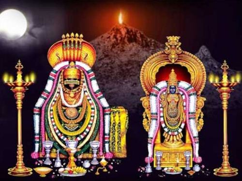
In Hinduism, Parvati, wife of Shiva, once closed the eyes of her husband playfully in a flower garden at their abode atop Mount Kailash. Although only a moment for the gods, all light was taken from the universe, and the earth, in turn, was submerged in darkness for years. Parvati performed penance with other devotees of Shiva, and her husband appeared as a column of fire at the top of Annamalai hills, returning light to the world.[4] He then merged with Parvati to form Ardhanarishvara, the half-female, half-male form of Shiva.[5] The Annamalai, or red mountain, lies behind the Annamalaiyar temple, and is associated with the temple of its namesake.[6] The hill is sacred and considered a lingam, or iconic representation of Shiva, in itself.[7] Another legend is that once, while Vishnu and Brahma contested for superiority, Shiva appeared as a flame, and challenged them to find his source.[8][9] Brahma took the form of a swan, and flew to the sky to see the top of the flame, while Vishnu became the boar Varaha, and sought its base. The scene is called lingothbava, and is represented in the western wall at the sanctum of most Shiva temples. Neither Brahma nor Vishnu could find the source, and while Vishnu conceded his defeat, Brahma lied and said he had found the pinnacle. In punishment, Shiva ordained that Brahma would never have temples on earth in his worship.[8] In Tamil, the word Arunam means red or fire and Asalam means hill. Since Shiva manifested himself in the form of fire in this place, this name Arunachalam came to be associated with Annamalai hill and the town.[9] The first mention of Annamalai is found in Tevaram, the seventh century Tamil Saiva canonical work by Appar and Tirugnanasambandar.[10]
History
Thiruvannamalai Annamalaiyar Temple Gopuram and Mandapam View
Thiruvannamalai Annamalaiyar Temple Gopurams
The history of Tiruvannamalai revolves around the Annamalaiyar Temple. The recorded history of the town dates back to the ninth century, as seen from a Chola inscriptions in the temple.[9][11] Further inscriptions made before ninth century indicate the rule of Pallava kings, whose capital was Kanchipuram.[12] The seventh century Nayanar saints Sambandar and Appar wrote of the temple in their poetic work, Tevaram. Sekkizhar, the author of the Periyapuranam records both Appar and Sambandar worshiped Annamalaiyar in the temple.[10] The Chola Kings ruled over the region for more than four centuries, from 850 to 1280, and were temple patrons. The inscriptions from the Chola king record various gifts like land, sheep, cow and oil to the temple commemorating various victories of the dynasty.[8]
Thiruvannamalai Annamalaiyar Temple Raja Gopuram
The Hoysala kings used Tiruvannamalai as their capital beginning in 1328.[9][13] There are 48 inscriptions from the Sangama Dynasty (1336–1485), two inscriptions from Saluva Dynasty, and 55 inscriptions from Tuluva Dynasty (1491–1570) of the Vijayanagara Empire, reflecting gifts to the temple from their rulers.[14] There are also inscriptions from the rule of Krishnadeva Raya (1509–1529), the most powerful Vijayanagara emperor,indicating further patronage.[12] Most of the Vijayanagara inscriptions were written in Tamil, with some in Kannada and Sanskrit.[15] The inscriptions in the temple from the Vijayanagara kings indicate emphasis on administrative matters and local concerns, which contrasts the inscriptions of the same rulers in other temples like Tirupathi. The majority of the gift related inscriptions are for land endowments, followed by goods, cash endowments, cows and oil for lighting lamps.[12] The town of Tiruvannamalai was at a strategic crossroads during the Vijayanagara Empire, connecting sacred centers of pilgrimage and military routes.[16] There are inscriptions that show the area as an urban center before the precolonial period, with the town developing around the temple, similar to the Nayak ruled cities like Madurai.[16][17]
During the 17th century, Tiruvannamalai came under the dominion of the Nawab of the Carnatic. As the Mughal empire came to an end, the Nawab lost control of the town, with confusion and chaos ensuing after 1753.[4] Subsequently, there were periods of both Hindu and Muslim stewardship of the temple, with Muraru Raya, Krishna Raya, Mrithis Ali Khan, and Burkat Ullakhan besieging the temple in succession. As European incursions progressed, Tiruvannamalai was attacked by French Soupries, Sambrinet, and the English Captain Stephen Smith. While some were repelled, others were victorious. The French occupied the town in 1757 and it came under the control of the British in 1760.[8] In 1790, Tiruvannamalai town was captured by Tippu Sultan, who ruled from 1750–99.[4] During the first half of the 19th century, the town came under British rule.[8]
Geography
Annamalai Hill
Tiruvannamalai is situated 196 km (122 mi) from the state capital Chennai and 210 km (130 mi) from Bangalore. The height of the Annamalai hill is approximately 2,669 ft (814 m).[18] Tiruvannamalai is located at 12°N 79.05°E. It has an average elevation of 200 metres (660 ft). The town is located to the east of Eastern Ghats. The topography of Tiruvannamalai is almost plain sloping from west to east. Tiruvannamalai experiences hot and dry weather throughout the year. The temperature ranges from a maximum of 40 °C (104 °F) to a minimum of 20 °C (68 °F). Like the rest of the state, April to June are the hottest months and December to January are the coldest. Tiruvannamalai receives scanty rainfall with an average of 815 mm (32.1 in) annually, which is lesser than the state average of 1,008 mm (39.7 in). The southwest monsoon with an onset in June and lasting up to August brings scanty rainfall. Bulk of the rainfall is received during the northeast monsoon in the months of October, November and December. The average humidity of the town is 77% and varies between 67% to 86%. During the summer months of April to June, the humidity ranges from 47–63%. The municipality covers an area of 16.3 km2 (1,630 ha)
Courtesy : wikipedia


